Manitou River – Site M-37 Paquette Farm
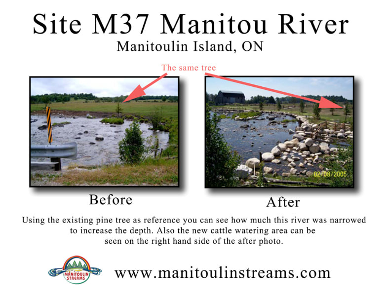
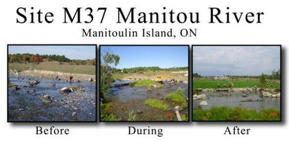
Riparian Zone Rehabilitation work commenced with the installation and strategic placement of 600mm boulders to mitigate against unmanaged cattle pressure on riparian habitat. This was done through creating an alternative area where cattle pressure could concentrate, thus gaining access to water with minimal impacts on riparian habitat and associated water quality. This site was chosen as having the highest suitability because the underlying bedrock substrate minimizes soil erosion and sedimentation while still providing the benefit of water access for cattle to the client.
This community driven project set out to improve the ecological diversity and productivity of the Manitou River. The work was completed according to the site plans through the cooperation of landowners, dedication of volunteers, consulting expertise of Great Lakes Environmental Services (GLES) and equipment, material, and services of C. Pearson & Son Excavation & Haulage. Aquatic restoration work completed included the installation and strategic placement of 600mm boulders to channelize flow and prevents further scouring of the riverbank which subsequently leads to sedimentation of the riverbed. A number of rock islands were also installed to redirect and concentrate flow and deepen the existing stream channel. Fish habitat features including root wads, lunkers and sweepers were also installed in the channel to increase resting, foraging, and rearing habitat for fish.
Planting of native trees, shrubs and grass species followed the installation of boulders. Species included speckled alder, eastern white cedar, red-osier dogwood, birds-foot trefoil and white clover were planted with high density to further augment shoreline stability. Split cedar rail fence was constructed along the periphery of the re-vegetated area to prevent cattle entrance to the restored riparian habitat zone.
Post construction site visits by GLES found the riparian vegetation community to have established itself well, thus acting to stabilize the stream bank along the entirety of the 400m of shoreline.