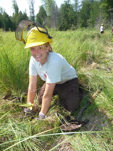
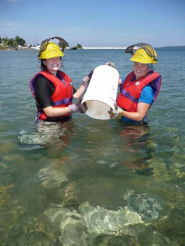
2010 Project Sites
Bass Lake Creek
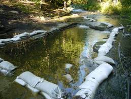
Spawning Habitat Enhancement Project
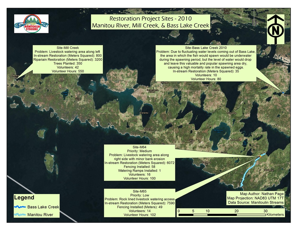
The 2010 Bass Lake Creek spawning habitat enhancement project site is traditionally a very active spawning area specifically for Walleye, Salmon and Trout. Due to fluctuating water levels coming out of Bass Lake the area in which the fish would spawn would be underwater during the spawning period, but the level of water would drop and leave this valuable and popular spawning area dry, causing a high mortality rate in the spawned eggs.
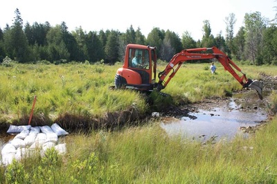
In order to rehabilitate or enhance this site, a plan was created to chisel and excavate a 5m x 7m (approx. 16’ x 24’) area of shale Lindsay formation to a depth of 1.3 metres below its current level and fill the bottom 30 cm with spawning gravel. The total surface area of enhanced productive spawning area produced was 35m2. The project brought the river bed in this area flush with the rest of the river bed, which allowed this popular spawning area to be underwater year round. Also, conducted at this site was bank stabilization where another 7m x 4m or 28m2 was repaired, graded and planted with Right of Way mixture grass seed.
Funding contributions toward the construction of the project include CFWIP, COA and NOHFC.
This project had 3 volunteers from the Little Current Fish and Game Club, 2 volunteers worked a combined 10 hours on preparation work at the site consisting mostly of delivery and washing of spawning gravel. The landowner provided 18.5 hours of site supervision and preliminary site visits with contractors for the project.
This project also had 7 volunteers from the Board of Directors of Manitoulin Streams participate in planning and actively volunteering at rehabilitation sites. The total number of hours volunteered for this site is 51.4 hours.
Mill Creek
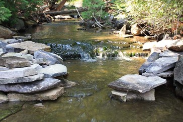
Rehabilitation and Enhancement Project
This approximate 400m long coldwater spring fed creek had several issues affecting it. The middle 2/3 of the creek was once backed up by beaver activity, which created a marsh that drowned all of the riparian and canopy vegetation. The beaver activity is no longer an issue, however the resulting beaver meadow needed to have riparian and canopy trees/shrubs planted to rehabilitate this area. Another issue affecting the creek was lack of spawning gravel and rounded rocks to provide invertebrate habitat in most areas. For the most part, the creek bed was covered in medium/large flat stones. Some areas of the stream had seen a previous owner use heavy equipment to remove beaver dams and lodges, which scraped some parts the creek bed clear of suitable spawning and invertebrate habitat. Finally, a steep incline, with large rock shelves at the mouth up to 100m of the start of the creek created migration difficulties.
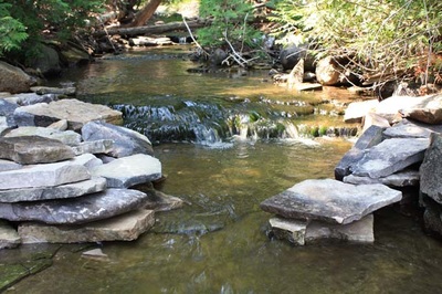
The resulting rehabilitation effort saw trees and shrubs planted in the riparian and canopy zones. Spawning gravel was added to the creek bed in several key locations near the mid and upper reaches. Large flat rock was used to reinforce the banks in the beaver meadow area to prevent erosion and to create a more defined channel. Woody material and rounded cobble stone type in-stream habitat was added and weeping weirs and wing deflectors were created to increase velocity and depth to allow for easier migration, oxygenation and the scouring and removal of silt from the creek bed.
The rehabilitation of Mill Creek in Meldrum Bay, ON involved the installation of the following fish habitat features:
This project had 4 OMNR Manitoulin Area Stewardship Rangers and 1 leader who put in 120 hours worth of work. This project also had 21 OMNR Stewardship Rangers from Killarney Provincial Park and 3 leaders who put in 192 hours worth of work.
The 5 Dawson’s Citizens Improvement Association members and 3 Gore Bay Fish and Game Club members put in 178 hours worth of preparation work, gathering materials and labour.
In-kind support from the community included deliver spawning gravel, donation of use of a large excavator, donation of use of a mini excavator and the use of 3 ATV’s to move materials during the rehabilitation phase.
This project had 7 volunteers from the Board of Directors of Manitoulin Streams participate in planning and actively volunteering at rehabilitation sites. The total number of hours volunteered for this site is 51.4 hours.
The landowner contributed approximately 8 hours of volunteer time and use of facilities at the Mill Creek site. Funding contributions toward the construction of the project include CFWIP, COA, and NOHFC .
This approximate 400m long coldwater spring fed creek had several issues affecting it. The middle 2/3 of the creek was once backed up by beaver activity, which created a marsh that drowned all of the riparian and canopy vegetation. The beaver activity is no longer an issue, however the resulting beaver meadow needed to have riparian and canopy trees/shrubs planted to rehabilitate this area. Another issue affecting the creek was lack of spawning gravel and rounded rocks to provide invertebrate habitat in most areas. For the most part, the creek bed was covered in medium/large flat stones. Some areas of the stream had seen a previous owner use heavy equipment to remove beaver dams and lodges, which scraped some parts the creek bed clear of suitable spawning and invertebrate habitat. Finally, a steep incline, with large rock shelves at the mouth up to 100m of the start of the creek created migration difficulties.
The resulting rehabilitation effort saw trees and shrubs planted in the riparian and canopy zones. Spawning gravel was added to the creek bed in several key locations near the mid and upper reaches. Large flat rock was used to reinforce the banks in the beaver meadow area to prevent erosion and to create a more defined channel. Woody material and rounded cobble stone type in-stream habitat was added and weeping weirs and wing deflectors were created to increase velocity and depth to allow for easier migration, oxygenation and the scouring and removal of silt from the creek bed.
The rehabilitation of Mill Creek in Meldrum Bay, ON involved the installation of the following fish habitat features:
- A total length of 400 linear meters of river rehabilitated
- A total of 800 m2 of in stream habitat rehabilitated.
- Approximate 10 m buffer of riparian area along both sides of a 160 m section of marshy area created which accounts for 3,200 m2 of riparian and canopy area.
- 3 pools excavated 6m x 2m x 0.3 m deep. River bed deepened to accommodate erosion and low water levels.
- 8 weeping weirs installed to create pools and scouring downstream.
- 3 wing deflectors installed
- Shoreline reinforced with dinner plate sized limestone rocks.
- 4 cubic meters of spawning gravel spread throughout the upper half of the creek.
- 350 – 0.30 m high, white ash and high bush cranberry trees planted.
- 2 half ton loads of 5 to 10 inch rounded cobble stone installed randomly in creek bed for invertebrate habitat.
- 20 pieces of woody material installed.
This project had 4 OMNR Manitoulin Area Stewardship Rangers and 1 leader who put in 120 hours worth of work. This project also had 21 OMNR Stewardship Rangers from Killarney Provincial Park and 3 leaders who put in 192 hours worth of work.
The 5 Dawson’s Citizens Improvement Association members and 3 Gore Bay Fish and Game Club members put in 178 hours worth of preparation work, gathering materials and labour.
In-kind support from the community included deliver spawning gravel, donation of use of a large excavator, donation of use of a mini excavator and the use of 3 ATV’s to move materials during the rehabilitation phase.
This project had 7 volunteers from the Board of Directors of Manitoulin Streams participate in planning and actively volunteering at rehabilitation sites. The total number of hours volunteered for this site is 51.4 hours.
The landowner contributed approximately 8 hours of volunteer time and use of facilities at the Mill Creek site. Funding contributions toward the construction of the project include CFWIP, COA, and NOHFC .
Manitou River
-
Site M 64
-
Site M 65
<
>
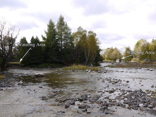
Channel Rehabilitation
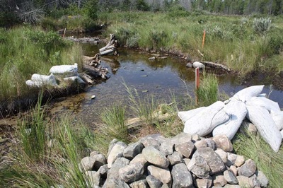
Site M-64 is a site where extensive erosion and scouring of the stream bed habitat had occurred over the past century due to previous poor land use practices and log drives. In addition to this fluctuating and low water levels decreased the depth of the water in this wide section of the river. In order to rehabilitate this site, bio-engineered site design methods concentrated on restoring the proper bank width, which in turn accomplishes two goals of the strategy in reducing river width and increasing river depth. A large excavator mounted hydraulic rock hammer created pools in the soft limestone, constrictors such as “W” weirs and wing deflectors were installed to narrow overall width and thereby increasing the rivers depth and provide in stream cover. Large boulders were strategically placed to positively utilize water flows and to create more in-stream aquatic habitat.
The rehabilitation of site M64 involved the installation of the following 55 fish habitat features along an approximately 120m long section of the Manitou River: one (1) holding pool excavated into bedrock, four (4) random boulders, one (1) single wing deflecto, two (2) pools excavated into bedrock, one (1) flume, six (6) boulder clusters of 3 Total 18 boulders, one (1) “W” Weir, three (3) boulders along an existing bank, two (2) L.U.N.K.E.R.’s, ten (10) root wads over 20m of shoreline complete with back-fill, grass and riparian, vegetation, upgrading of an existing cattle watering pad including the placement of additional, boulders around its perimeter and installation of angled cobble on the pad itself. 12 boulders in total.
A total of 6072 m2 of in stream habitat rehabilitated. Approximate 10 m width buffer of riparian area created which accounts for 579 m2 of riparian and canopy area. With volunteer help a section of fence 57.91 meters in length was repaired and installed to restrict livestock access to the river. Eight (8) volunteers put in 16 hours installing the above mentioned fence.
This project had 7 volunteers from the Board of Directors of Manitoulin Streams participate in planning and actively volunteering at rehabilitation sites. The total number of hours volunteered for this site is 51.4 hours.
The landowner contributed 26 hrs of labour and 6 hrs of attending meetings and the in-kind support included supplying materials, cedar rail fencing (175 rails), nails, wire, use of tractor and chainsaw.
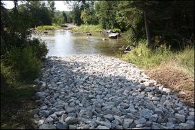
Channel Rehabilitation
Site M-65 is a site where extensive erosion and scouring of the stream bed habitat had occurred over the past century due to previous poor land use practices and log drives. In addition to this fluctuating and low water levels decreased the depth of the water in this wide section of the river. In order to rehabilitate this site, bio-engineered site design methods concentrated on restoring the proper bank width, which in turn accomplished two goals of the strategy in reducing river width and increasing river depth. A large excavator mounted hydraulic rock hammer created pools in the soft limestone, constrictors such as “W” weirs and wing deflectors were installed to narrow overall width and thereby increasing the rivers depth and provide in stream cover. Large boulders were strategically placed to positively utilize water flows and to create more in-stream aquatic habitat. A designated vehicle crossing, a ford, was enhanced to prevent erosion at entry and exit points.
The rehabilitation of site M65 involved the installation of the following fish habitat features along an approximately 170m long section of the Manitou River: seven (7) boulder clusters, one (1) “W” Weir, five (5) pools excavated into bedrock, two (2) ramps associated with an existing ford, four (4) single wing deflectors, prepare and implement an erosion and sediment control plan. 48.76 m of split cedar rail fencing installed to restrict livestock.
A total of 7590 m2 of in stream habitat was rehabilitated. This project had 7 volunteers from the Board of Directors of Manitoulin Streams participate in planning and actively volunteering at rehabilitation sites. The total number of hours volunteered for this site is 51.4 hours. Six 6 volunteer fence builders put in a total of 12 hours.
The landowner contributed 32 hrs of labour and 7 hrs of attending meetings and the in-kind support included supplying materials, boulders, rocks, and fencing.
Mindemoya River
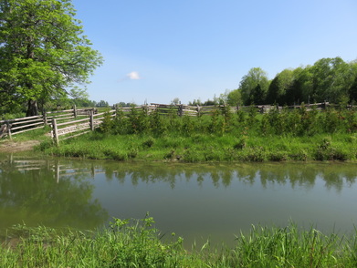
Cattle Restriction, Rehabilitation and Enhancement
Sites MIN 302, 304 and 306 had extensive erosion and lack of canopy due to improper land use practices and unrestricted livestock access. Fluctuating water levels also undermined the stability of the banks creating large amounts of erosion and sediment discharge. In order to rehabilitate these 3 adjoining sites, bio-engineered site designs were created to prevent further erosion and sediment discharge. The above mentioned methods coupled with the installation of fencing and a designated livestock crossing/watering area, which will restrict livestock access to the banks and watercourse accomplishes two goals in the enhancement strategy. Large excavators were used to grade the vertical eroding banks back to a 2:1 slope. The resulting banks were vegetated with native grasses and tree/shrub species. A rock chute was installed on MIN 302 to allow for proper drainage and a designated livestock crossing with angled cobble and fencing installed at MIN 306 to prevent further erosion. Geo-textile and a large angled rock toe was created at the base of the banks to absorb the rivers energy and provide some much needed in-stream habitat. Fencing was also installed to keep livestock clear of the stream.
The rehabilitation of sites MIN 302, 304 and 306 involved the installation of the following fish habitat features along an approximately 83m long section of the Mindemoya River.
MIN 302
Rehabilitation of an approximately 25m long section of the Mindemoya River including the supply and installation of:
MIN 304
Rehabilitation of an approximately 23m long section of the Mindemoya River including the supply and installation of:
MIN 306
Rehabilitation of an approximately 35m long section of the Mindemoya River including the supply and installation of:
Overall – MIN 302, 304, 306
This project had 4 OMNR Manitoulin Area Stewardship Rangers and 1 leader who put in 80 hours worth of work. This project also had 21 OMNR Stewardship Rangers from Killarney Provincial Park and 3 leaders who put in 384 hours worth of work. Another 2 volunteers logged approximately 16 hours, running the chainsaw and planting trees.
This project had 7 volunteers from the Board of Directors of Manitoulin Streams participate in planning and actively volunteering at rehabilitation sites. The total number of hours volunteered for this site is 51.4 hours.
The landowner contributed 15 hrs of labour and 5 hrs of attending meetings and the in-kind support included supplying materials and fence rails 157 meters, as well as advice on and installation of the electric fence. The landowner also took the Environmental Farm Plan course and applied for funding for this project.
Funding contributions toward the construction of the project include CFWIP, COA and NOHFC.
Sites MIN 302, 304 and 306 had extensive erosion and lack of canopy due to improper land use practices and unrestricted livestock access. Fluctuating water levels also undermined the stability of the banks creating large amounts of erosion and sediment discharge. In order to rehabilitate these 3 adjoining sites, bio-engineered site designs were created to prevent further erosion and sediment discharge. The above mentioned methods coupled with the installation of fencing and a designated livestock crossing/watering area, which will restrict livestock access to the banks and watercourse accomplishes two goals in the enhancement strategy. Large excavators were used to grade the vertical eroding banks back to a 2:1 slope. The resulting banks were vegetated with native grasses and tree/shrub species. A rock chute was installed on MIN 302 to allow for proper drainage and a designated livestock crossing with angled cobble and fencing installed at MIN 306 to prevent further erosion. Geo-textile and a large angled rock toe was created at the base of the banks to absorb the rivers energy and provide some much needed in-stream habitat. Fencing was also installed to keep livestock clear of the stream.
The rehabilitation of sites MIN 302, 304 and 306 involved the installation of the following fish habitat features along an approximately 83m long section of the Mindemoya River.
MIN 302
Rehabilitation of an approximately 25m long section of the Mindemoya River including the supply and installation of:
- bank grading
- rock chute
- rock fill complete with underlying geotextile along the toe of bank grading
- riparian vegetation and canopy
- implementation of an erosion and sediment control plan
MIN 304
Rehabilitation of an approximately 23m long section of the Mindemoya River including the supply and installation of:
- bank grading
- rock fill complete with underlying geotextile along the toe of bank grading
- riparian vegetation and canopy
- implementation of an erosion and sediment control plan
MIN 306
Rehabilitation of an approximately 35m long section of the Mindemoya River including the supply and installation of:
- bank grading
- rock fill complete with underlying geotextile along the toe of bank grading
- riparian vegetation and canopy
- cattle access ramps and fencing
- implementation of the erosion and sediment control plan
- A total of 180 linear meters in shoreline and riparian linear length blocked from livestock access.
Overall – MIN 302, 304, 306
- A total of 498 m2 of in stream habitat rehabilitated.
- 4,320 m2 total riparian and canopy area created. (Average of 12 linear meters riparian area fenced off)
- 256 linear m of new split cedar rail fencing installed to restrict cattle access to river. (landowner supplied older rails to fill in remainder)
- 80 linear m of electric fencing installed to restrict cattle access to river. Electric fence area was fenced off to leave room for equipment to enter in potential 2011 project.
This project had 4 OMNR Manitoulin Area Stewardship Rangers and 1 leader who put in 80 hours worth of work. This project also had 21 OMNR Stewardship Rangers from Killarney Provincial Park and 3 leaders who put in 384 hours worth of work. Another 2 volunteers logged approximately 16 hours, running the chainsaw and planting trees.
This project had 7 volunteers from the Board of Directors of Manitoulin Streams participate in planning and actively volunteering at rehabilitation sites. The total number of hours volunteered for this site is 51.4 hours.
The landowner contributed 15 hrs of labour and 5 hrs of attending meetings and the in-kind support included supplying materials and fence rails 157 meters, as well as advice on and installation of the electric fence. The landowner also took the Environmental Farm Plan course and applied for funding for this project.
Funding contributions toward the construction of the project include CFWIP, COA and NOHFC.

